
sold by the Perth City Council to help fund the Park Recreation Centre and
was demolished in 1983. Frank the barber had a shop next to the entrance of the hall and paid about $27 per week for about twenty years. Frank is still cutting hair today.

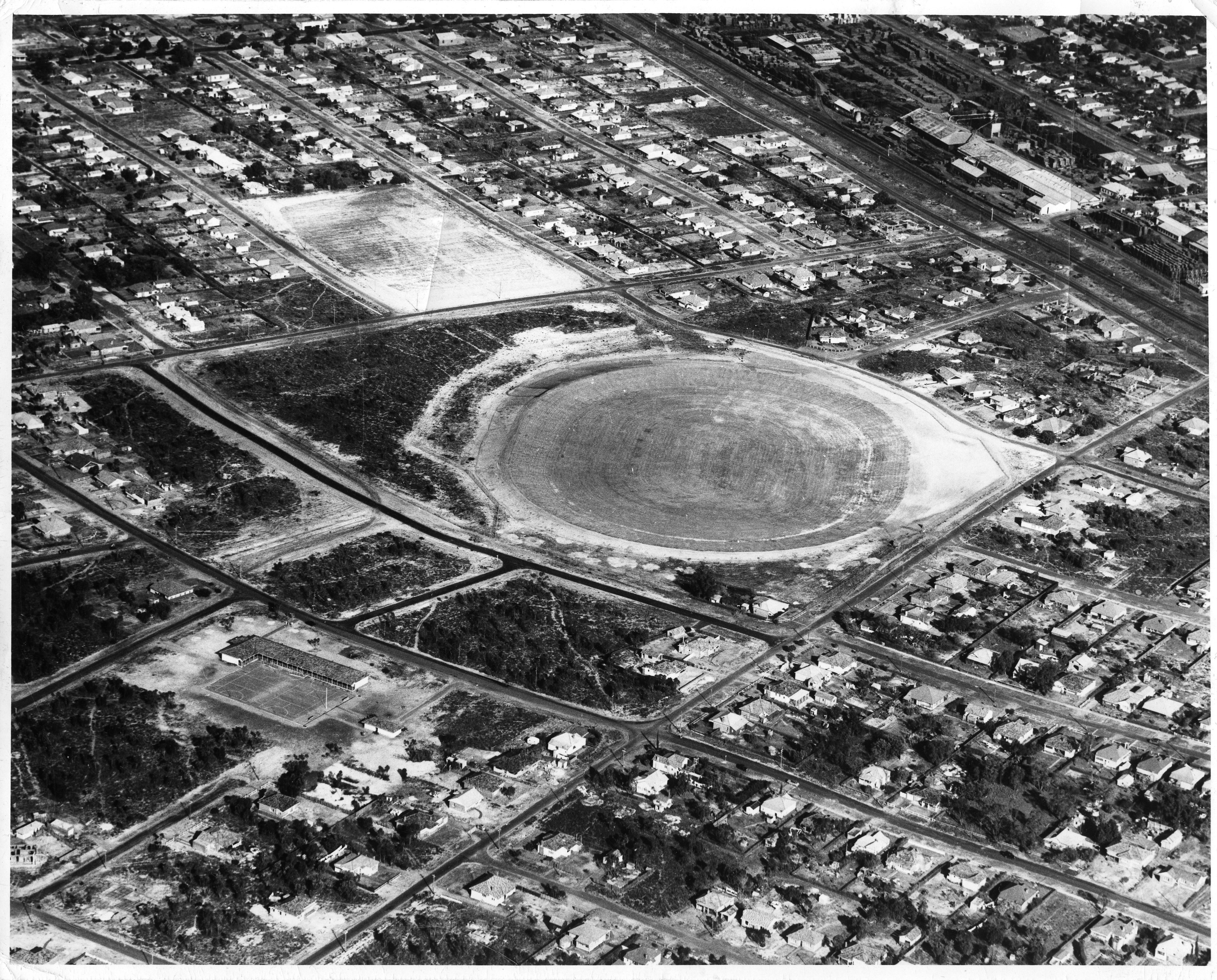
Lathlain Park the home of the Perth Football Club will soon also be the home of the West Coast Eagles (C2017).

The image is looking north down Albany Road. If you look closely you will see that the photographer had company on this day in 1889. A young man is leaning on the telegraph pole and to the youth’s left a large dog is laying down.
You can also just see that next to the tree on the right, that appears to have been either struck by lightning or burnt, a person is sitting to the left of the tree.
The photograph appears to have been taken on a bright sunny day at around about 9 or 10 o’clock in the morning.
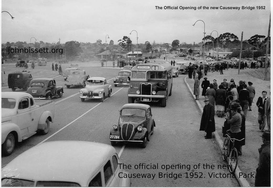
Looking south toward Victoria Park WA along Albany Highway.
The dreaded roundabout is in the background.
The Brisbane Wunderlick windmill is also in the background.
-

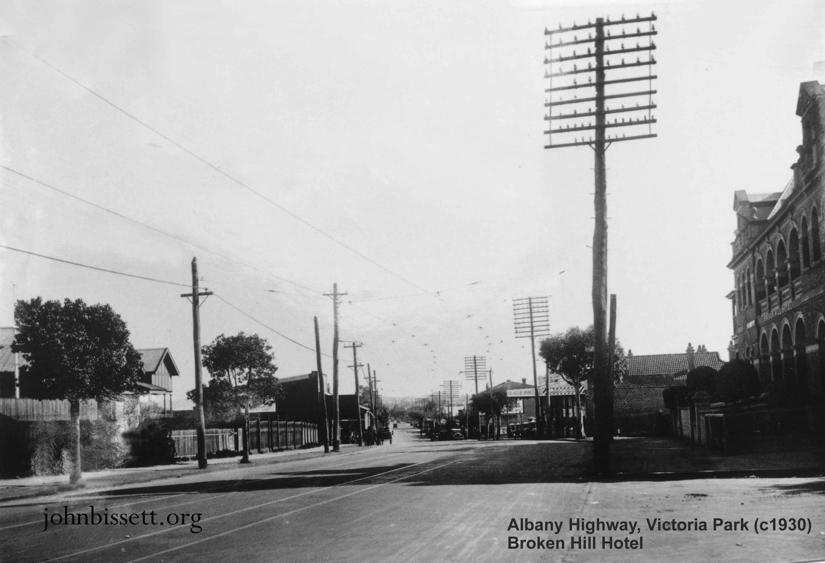
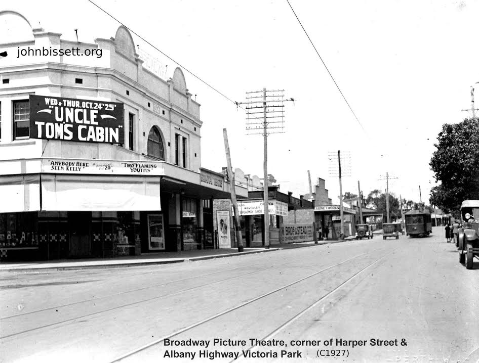
Corner of Harper St and Albany Hwy, Victoria Park (c1930). Looking north with the Broken Hill Hotel on the right and the old telegraph poles along the highway.

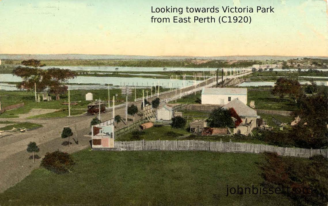
Photographed from East Perth looking south.
Note the tram and the hump on the Causeway
which allowed steam boats to lower their chimneys
to go up the River Swan to Guildford.
Victoria Park WA is seen in the distance.

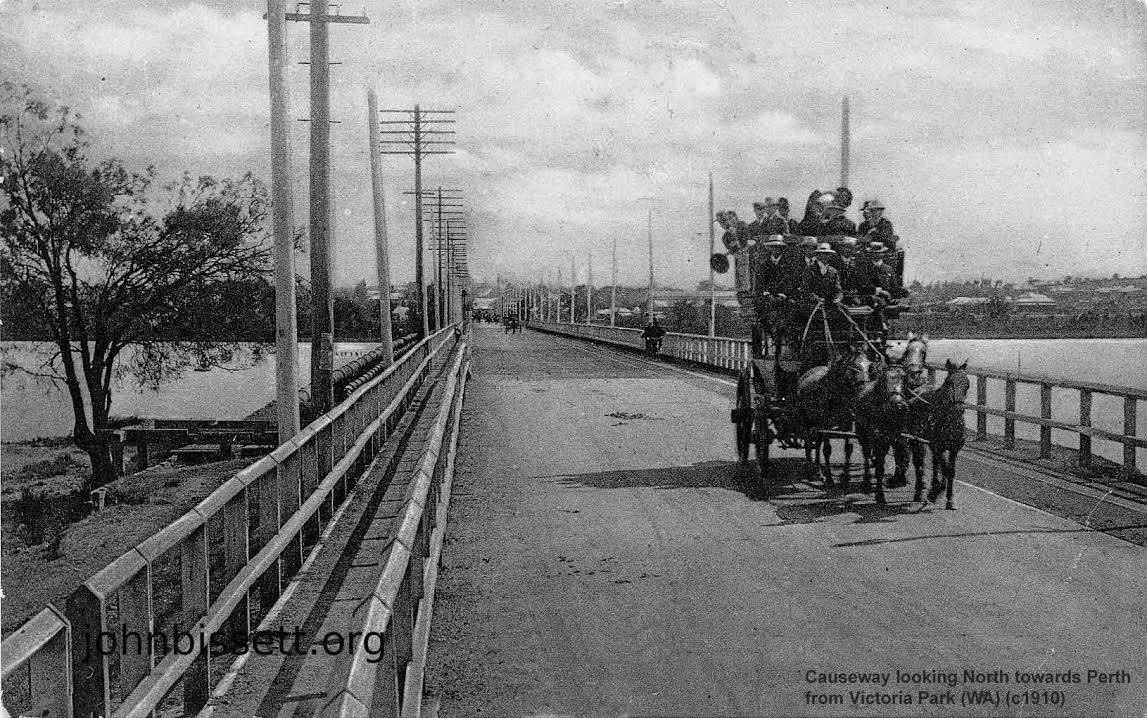
Note the telephone lines and the tram track adjacent to the
overloaded coach.
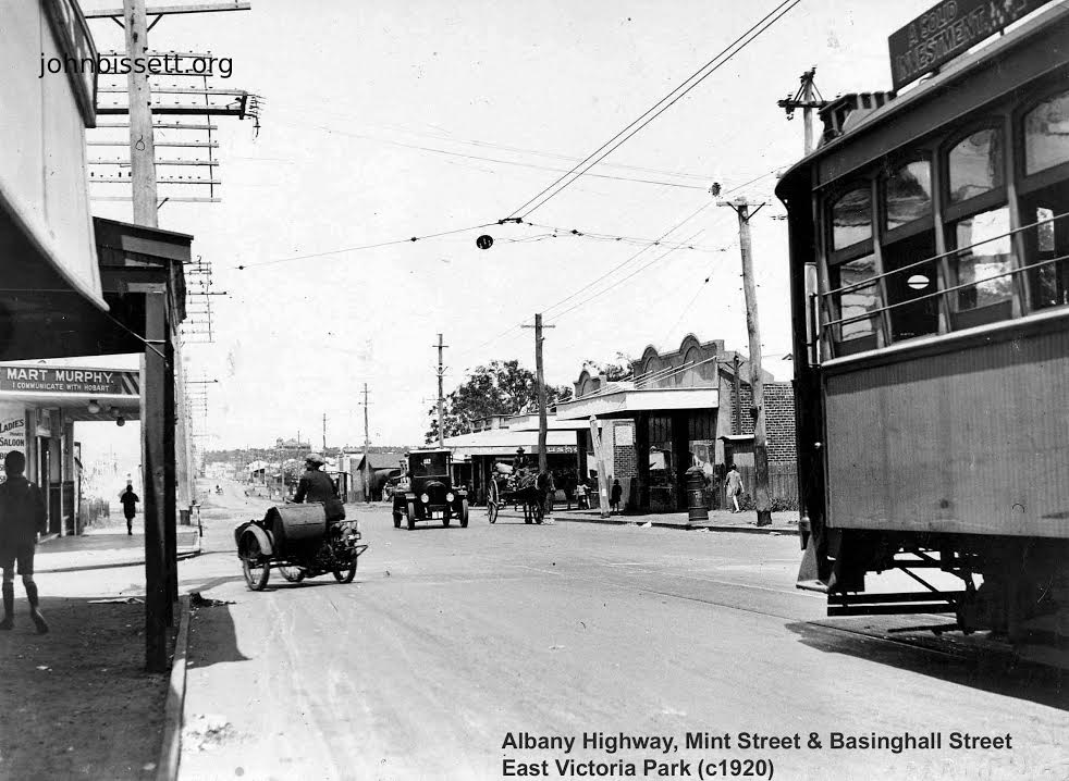
The junction of Mint St and Basinghall St East Victoria Park WA.
Note the combination of travel, tram, motor cycle, motor car,
horse drawn wagon and walking.
This was a tram terminus note overhead wires.
In the distance you can see the outline of the Edward Millen House.
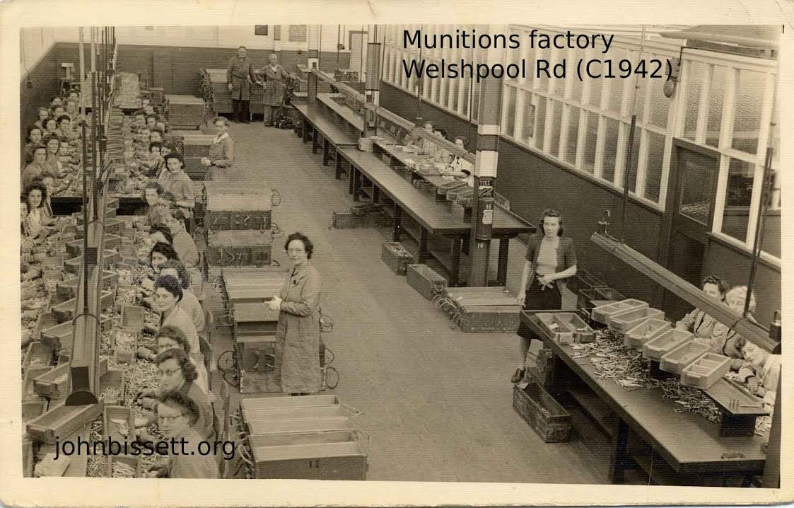
Over 42 dedicated war workers are in this photo.
Some of the unsung heroes of the 2nd WW.


Bengt Leander 94 years ord nog is very happy tosee these pictures from his Hometown. He was talkonst today about Wien he went by the tram downtown from Carrol terrace. Bengt has been living in Sweden since 1937. Tank You for sharing.
very interesting.
Are you sure Perth Football Oval (1960) area, was known as in the suburb of Rivervale?
The suburb of “Lathlain Park” was bordered by Roberts Road, Orrong Road, Goddard Street and Rutland Avenue.
The name change from “Lathlain Park” to the suburb of “Lathlain” was created by increasing the suburb size from Roberts Road, Orrong Road, Rutland Avenue and back to Roberts Road. Originally the area between Goddard Street, Orrong Road, Rutland Avenue and back to Goddard Street was part of Victoria Park.
Sorry about the delay in answering you.
I was on the PCC when we formerly declared Lathlain. It was about 1982. Prior to that if you look at street maps prior to 1982 you should find that the area described was Rivervale. Kind regards John